Zimbabwe Was Not on Google Maps Until a Photographer Volunteered to Capture the Street View

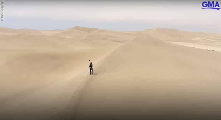
Tawanda Kanhema with the Google Street View camera. (Photo: Screenshot from GMA video, credited to Alan Sanchez)
Have you checked out your childhood home on Google Maps Street View? While addresses in America and Europe are typically easy to find and view, large swaths of land in Africa and Asia remain unmapped. Zimbabwean digital strategist and photographer Tawanda Kanhema encountered this fact while hoping to show a friend his own childhood home in Harare, the capital of Zimbabwe. Inspired, the Berkeley-based photographer returned to Zimbabwe to fill in the map. Partnering with Google and Insta360, Kanhema traveled about 2,000 miles by foot, boat, car, and air—all while recording his surroundings with a camera.
Kanhema told NPR, “I found it quite jarring that a lot of the countries in the region were not on the map…We should do more to make sure that those communities are represented.” Google Maps does use their own fleet of cameras to record street views in some areas, particularly metropolitan areas with lots of people and accessible roads. However, the world is an enormous place, and the need for accurate imaging and digital maps is increasing in importance no matter where one lives. Additionally, being represented on Google Maps can be a boon to an area's tourism.
Using cameras borrowed from Google and Insta360, Kanhema set out to record Zimbabwe. For part of his journey he was followed by a Google camera crew which recorded his epic journey over sand dunes and through city streets. Kanhema carried the camera on his back while hiking, biking, and riding ATVs. He also used cars, boats, and helicopters to cover a variety of terrain. His journey covered over 2,000 miles and is responsible for 500 miles of Street View now available across Zimbabwe. He even funded these travels with $5,000 of his own money.
Along his travels—which continued into Namibia—Kanhema captured footage of many scenic views. He filmed the iconic Victoria Falls, one of the world's largest waterfalls located along the border of Zambia and Zimbabwe (marked by the Zambezi River). Kanhema cited following the river as his favorite part of his mapping journey. With a camera on a speedboat, he encountered an elephant and hippos along the river. Kanhema also even filmed a shipwreck—the famous Zeila Shipwreck along the Namibian coast.
After his Zimbabwe travels, Kanhema has gone on to continue documenting the Unmapped Planet, creating a website of these virtual tours. His travels have also included mapping hundreds of miles of Northern Ontario. As Kanhema told Good Morning America, “A map is never final. People are constantly adding more context, more perspectives, adding more voices towards the representations of these places and so for me it feels like just a gentle, gradual improvement in the digital coverage of places in Africa.” To follow Kanhema's map-making travels, check out his Instagram and website.
Zimbabwean photographer and digital strategist Tawanda Kanhema was determined to map the roads and landscapes of his home country after learning that Zimbabwe was not on Google Maps Street View.
View this post on Instagram
His journey took him thousands of miles as he documented 500 miles of roads in Zimbabwe—in addition to areas of other countries.
Tawanda Kanhema: Website | Instagram | Twitter
h/t: [Smithsonian]
Related Articles:
Missing Hiker Rescued After Man on Twitter Found His Location From a Photo of His Feet
Whitest Paint Ever Developed Could Reflect Enough Light to Slow Global Warming
Kenyan Materials Engineer Recycles Plastic Into Bricks That Are Stronger Than Concrete
Watch Animals Safely Cross Utah’s First Wildlife Overpass
READ: Zimbabwe Was Not on Google Maps Until a Photographer Volunteered to Capture the Street View

0 Commentaires